A Sense of Identity
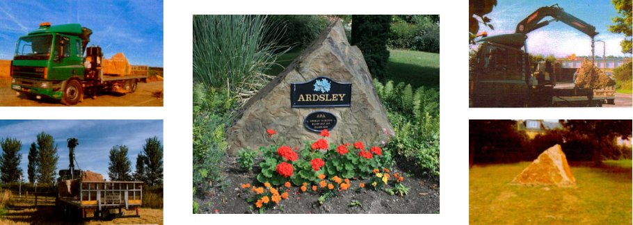
The village of Ardsley is on the main road (A635) between Barnsley and Doncaster. Unless you have local knowledge or looked on a map, the fact you had passed through the village may have been totally missed.
As a result, the Residents Association set about getting signage erected at both the west and east boundary. This was achieved by placing large locally quarried stones on which the village name was mounted.
As a result, the Residents Association set about getting signage erected at both the west and east boundary. This was achieved by placing large locally quarried stones on which the village name was mounted.
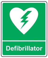
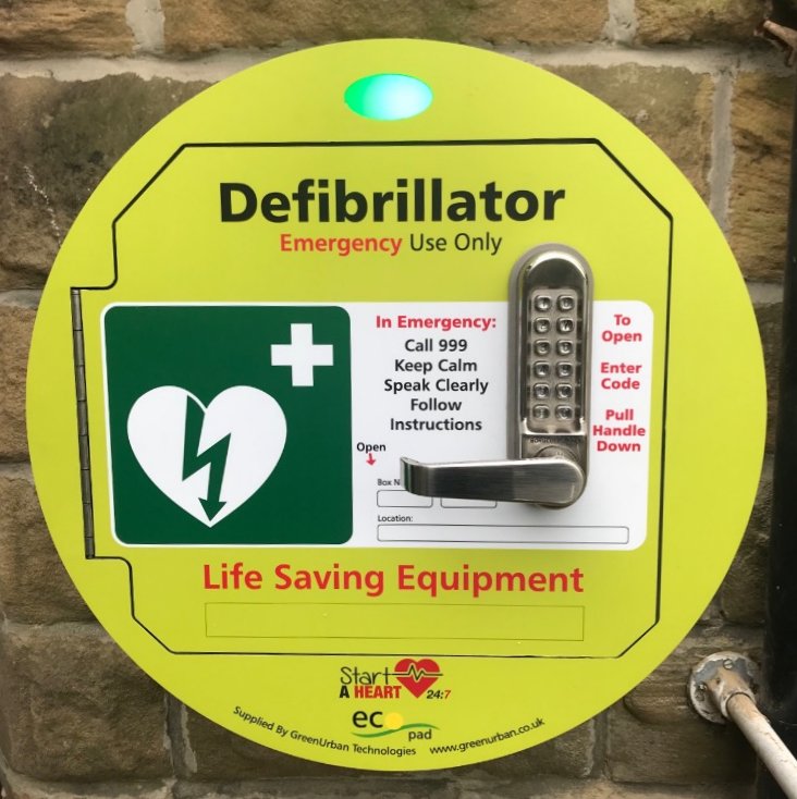
24 Hour Access Community Defibrillator
|
|
|
Following the efforts of the ARA and generous local donations, a 24 hour access community defibrillator was installed and registered with Yorkshire Ambulance Service in early 2018. It is located adjacent to the main entrance of the Church Hall in Ardsley and is available for public use via 999 emergency services. This central location within our village should ensure access to our residents should it be needed.
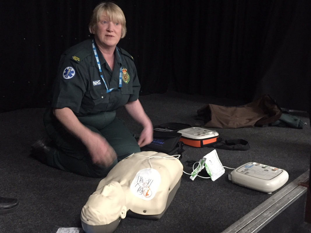
It is a self explanatory unit to use in case of suspected cardiac arrest. A familiarisation training session was held for all residents on Wednesday 7th March 2018, delivered by the Yorkshire Ambulance Service.
If you missed the session, why not watch the video provided by the British Heart Foundation which shows how they work.

Pacers Field
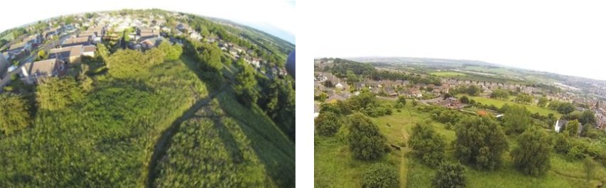
On the 29th July 2010 Ardsley Residents Association achieved their original aim. The Mayor Councillor Margaret Sheard and Consort Tom Sheard officially opened Pacers Field. It took six years and a lot of work in the planning, funding and implementation.
The field, previously called Scarfield, is council owned and a horse called Pacer grazed the field in the 1970s. Around this time allotments were also gardened at the Cumberland Drive/Scar Lane end of the field. Unfortunately the land had since fallen into neglect.
However the field has been used for recreational purposes for many years by residents. In 2004 the council planned a residential development for the field. Ardsley Residents Association was formed and objected. After some time the field was declared a green space. Discussions were held with all concerned as to the field’s future. Firstly it was decided that the field would be known as Pacers Field after the horse that grazed there and a project plan was proposed and accepted to develop the field for residents and visitors to enjoy the flora and fauna of the area.
The Probation Service, Community Service, Unpaid Work Unit agreed to carry out the work with support from Ardsley Residents Association and work started October 2009. Funding and support for the project has come from residents, local organisations/business, BMBC, Jo Birch Parks Officer, Howard Gaskin Neighbourhood Pride Area Manager, Stairfoot Ward Community Support Fund and a reduced rate for road plainings from Graham Bateson Smithies Depot.
The project has transformed and improved the area. Thanks to all the people and organisations involved.
|
|
Tranquil Garden
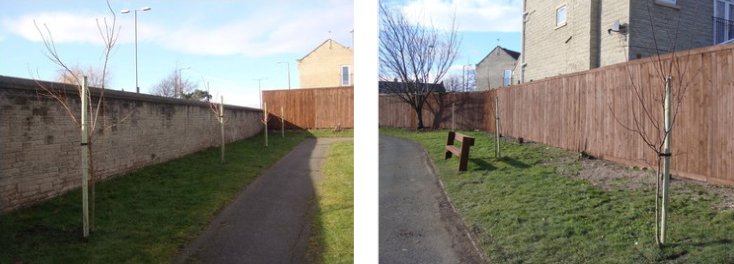
As a consequence of council cut-backs to the parks and gardens budget, planting within the garden area of the park has been neglected. In an effort to improve the area the Resident Association secured seven trees that were planted in the garden by the Probation Service Unpaid Work Unit.
Bloomin’ Ardsley
Planted flower barrels have been placed strategically around the village by the Residents Association to improve the appearance of the village, focussed along the main road. These have now been planted and maintained each year by a group of volunteers. Assistance in this task is greatly appreciated, whether a little light weeding or watering during the warm summer months.
In addition to these, daffodils have also been planted along the central reservation to brighten up the village in early spring.
In addition to these, daffodils have also been planted along the central reservation to brighten up the village in early spring.
|
|
Trans Pennine Trail
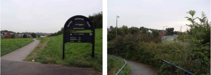
The Trans Pennine Trail (TPT) is an exciting route for walkers, cyclists and horse riders linking the North and Irish seas. It passes through the Pennines, alongside rivers and canals and through some of the most historic towns and cities in the North of England.
The Trail from coast-to-coast between Southport and Hornsea is 215 miles (346Km) long. A north-south route connects Leeds and Chesterfield and a spur to York means there are approximately 350 miles (560 km) of Trans Pennine Trail available to explore.
The Trans Pennine Trail is mapped and signed all the way, mainly traffic free and is surprisingly level considering the dramatic scenery along the way. Easy gradients and surfaced paths make many sections suitable for families, gentle exercise and people using wheelchairs and pushchairs. So whether on foot, horse or cycle; for a day or longer; alone with friends and family - the Trans Pennine Trail (TPT) can offer something for everyone.
In Ardsley the trail is located at the west side of the village, over an old railway bridge and parallel to Grange Lane.
Awards
ARDSLEY RESIDENTS ASSOCIATION Winners of:
- YORKSHIRE ROSE AWARD SILVER 2009
- TARA Delivering Projects Award 2009
- TARA of the year 2009
- BMBC Neighbourhood Services Community Award 2010
- TARA of the year 2010
- YORKSHIRE ROSE AWARD SILVER GILT 2011